Tracing the Roots: The Historical Significance of Land Surveying
Land surveying, the art and science of measuring terrains and boundaries, has been an essential cornerstone of human civilization. Its significance can be traced back to ancient times when civilizations depended on accurate boundary delineations for agriculture, construction, and territorial claims.
- The Ancient Egyptians relied on rudimentary tools and basic geometry to redefine boundaries, especially after the annual inundations of the Nile River. These flood events often erased property markers, necessitating regular re-surveys.
- The Romans, with their vast territories and intricate road networks, had specialized surveyors known as “Gromatici.” These professionals used the “Groma,” a Roman surveying instrument, to plan cities, aqueducts, and roads.
Embracing Technology: The Digital Evolution in Land Surveying
The transition from traditional to digital in the world of land surveying has been nothing short of revolutionary. As technology advanced, the methods and tools used in surveying evolved, leading to increased accuracy, efficiency, and scope.
- The advent of Global Positioning System (GPS) technology marked a significant milestone. With GPS, surveyors could achieve unprecedented accuracy in their measurements, even in challenging terrains.
- Modern software solutions, equipped with user-friendly interfaces and powerful features, have transformed the way surveyors work. Tasks that once took days can now be completed in hours, thanks to automation and real-time data processing.
In today’s digital age, software applications are not just tools but essential partners, aiding surveyors in their quest to map the world around us.
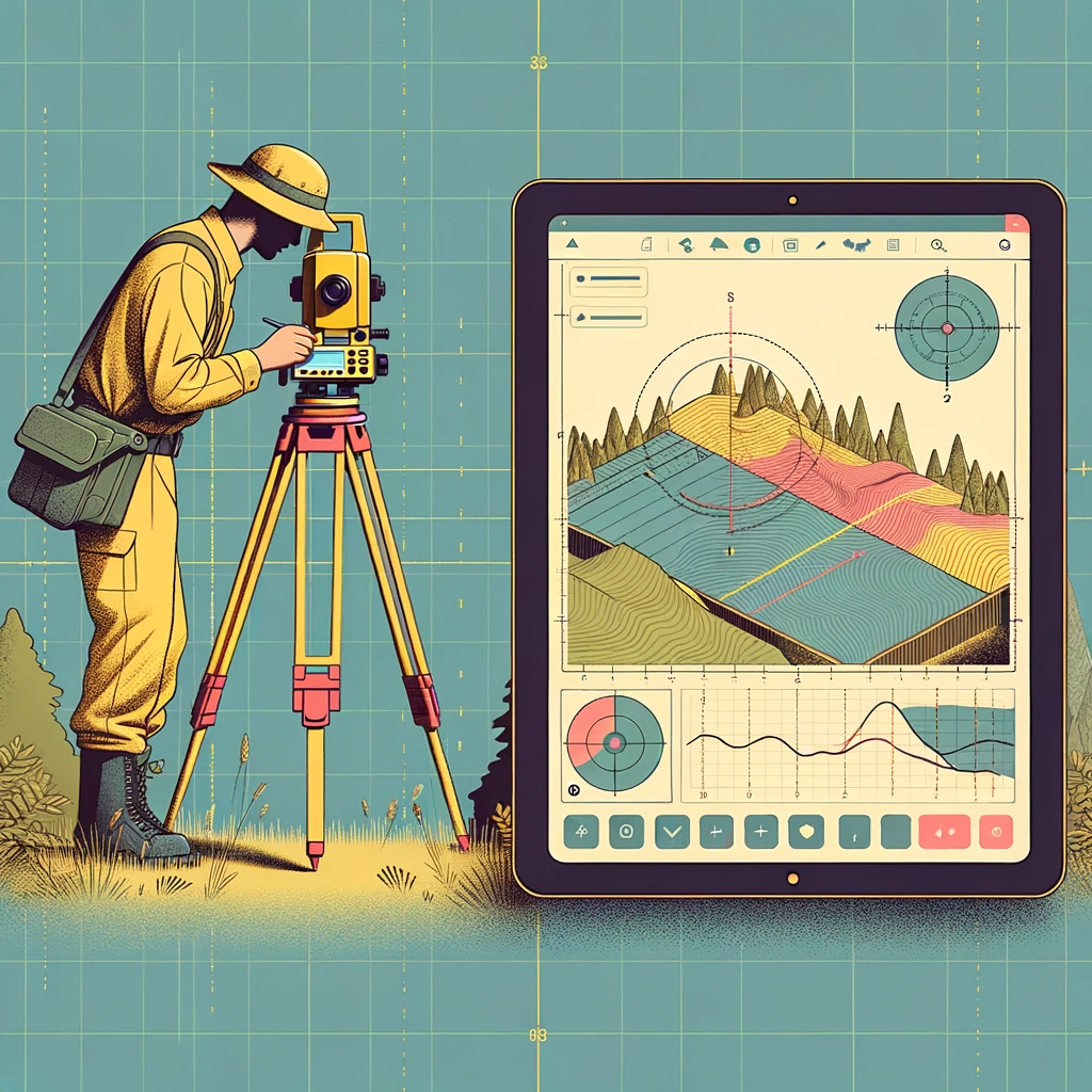
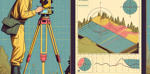
Beyond Measurements: The Multifaceted Role of Software in Modern Land Surveying
Today’s land survey software is a blend of advanced algorithms, user-centric design, and versatile functionalities. These software solutions cater to a myriad of needs, from basic measurements to intricate 3D modeling.
- Data Collection: Modern software facilitates seamless data collection, allowing surveyors to instantly capture and store information from the field. This data forms the foundation of their subsequent analyses and reports.
- Visualization: With advanced rendering tools, surveyors can create detailed maps, topographical models, and 3D visualizations. These visual aids are invaluable in presentations, stakeholder meetings, and project planning.
- Integration: The ability to integrate with other tools and platforms means that survey software can be a part of a larger ecosystem. Whether it’s syncing with drones for aerial surveys or connecting with GIS databases, integration enhances the surveyor’s toolkit.
Choosing the right software is akin to selecting a trusted partner. As the demands of the industry grow and projects become more complex, having a reliable software solution becomes indispensable for every surveying professional.
Navigating the Digital Terrain: A Deep Dive into Leading Land Survey Software Solutions
The digital transformation of land surveying has ushered in a new era of precision, efficiency, and versatility. As the industry evolves, software solutions have become the linchpin, enabling surveyors to tackle complex projects with unparalleled accuracy. Let’s delve deeper into some of the frontrunners in this domain.

SurvCE by Carlson Software
SurvCE is not just a software; it’s a comprehensive ecosystem designed to empower surveyors. With its robust features and user-centric design, SurvCE has carved a niche for itself in the industry.
- Platform Compatibility: Primarily tailored for Windows mobile devices, SurvCE’s adaptability ensures that surveyors can operate in diverse environments without compatibility hiccups.
- Features:
- Command style data entry, making the process intuitive and reducing the learning curve.
- A dynamic map view that not only captures but also allows staking out of land survey data, providing a visual representation of the terrain.
- A versatile file support system, accommodating CAD, GIS data, and more, ensuring seamless data integration and transfer.
- Real-time GPS integration, a game-changer, ensuring pinpoint accuracy in data collection.
FieldGenius by MicroSurvey
FieldGenius, as the name suggests, brings a touch of genius to field surveying. It’s a harmonious blend of traditional techniques and cutting-edge digital tools.
- Platform Compatibility: With support for Android, Windows Mobile, and Windows 10, FieldGenius offers a broad spectrum of device compatibility.
- Features:
- The code-free 3D line drawing capability eliminates complexities, allowing surveyors to visualize data effortlessly.
- Advanced total station controls ensure that measurements are not just accurate but also consistent.
- The real-time digital terrain modeling feature captures the intricacies of the land, providing a detailed topographical view.
X-PAD Survey by GeoMax
X-PAD Survey is a testament to innovation. It seamlessly integrates topographic and cadastral functionalities, making it a favorite among professionals.
- Platform Compatibility: While it’s optimized for Android, its adaptability extends to Windows Mobile.
- Features:
- A unique feature that integrates position data with multimedia elements like photos and voice comments, providing a holistic view of the surveyed area.
- Cloud compatibility ensures that data can be uploaded or downloaded without any hassles, promoting collaboration and data sharing.
- The comprehensive suite, including X-Pad Ultimate and CalMaster, provides a range of tools under one umbrella, catering to diverse surveying needs.
GeoPro Field by Sokkia
GeoPro Field is where simplicity meets power. It offers an intuitive interface without compromising on functionality, making it a go-to solution for many surveyors.
- Platform Compatibility: It’s versatile, supporting Android, Windows Mobile, and Windows 10.
- Features:
- Real-time imaging enhances visualization, allowing surveyors to get a clear picture of the terrain.
- Its ability to support a plethora of file types ensures that data integration is smooth.
- The seamless integration with Autodesk point layout adds another layer of versatility, especially for those involved in construction surveying.
Access by Trimble
Access by Trimble is more than just a software; it’s a complete surveying solution. Designed to cater to a range of surveying needs, it’s a perfect blend of functionality and user-friendliness.
- Platform Compatibility: From Android to Windows Embedded Handheld and Windows 10, its compatibility range is impressive.
- Features:
- The graphical staking feature is a standout, allowing precise marking of points, lines, and other elements.
- The integrated surveying technology is a fusion of optical scanning, GNSS data, and imagery, ensuring comprehensive data collection.
- Its built-in workflow applications are tailored for diverse projects, be it roads, pipelines, or tunnels, ensuring that surveyors have the right tools for every job.
Beyond the Surface: Delving Deeper into Software Capabilities
While a cursory overview provides a snapshot of what each software offers, a deeper dive can reveal the nuances that set them apart. In this section, we’ll dissect the functionalities, user experience, and integration capabilities of the leading land survey software solutions.
SurvCE by Carlson Software: A Comprehensive Toolkit
SurvCE is more than just a software; it’s a complete surveying ecosystem. Its robust set of features is complemented by an intuitive interface, making it a favorite among professionals.
- User Experience: The command-style data entry system is designed with the user in mind, ensuring that even those new to the software can navigate it with ease.
- Integration Capabilities: With support for a wide range of file types, including CAD and GIS data, SurvCE stands out in its ability to integrate seamlessly with other platforms. This ensures that data transfer and collaboration are hassle-free.
- Unique Selling Points:
- Real-time GPS integration ensures pinpoint accuracy in measurements.
- The dynamic map view offers a visual representation of the terrain, enhancing the user’s understanding of the surveyed area.
FieldGenius by MicroSurvey: Where Tradition Meets Innovation
FieldGenius is a harmonious blend of traditional surveying techniques and cutting-edge digital tools. Its dynamic data panels and synchronized map views set it apart from the competition.
- User Experience: The modern interface, combined with familiar tools, offers a nostalgic experience for seasoned surveyors while introducing innovative features that enhance productivity.
- Integration Capabilities: FieldGenius boasts advanced total station controls and real-time digital terrain modeling. Its ability to work in tandem with other platforms ensures that surveyors have all the tools they need at their fingertips.
- Unique Selling Points:
- The code-free 3D line drawing capability eliminates complexities, allowing for effortless visualization.
- Real-time digital support ensures that surveyors have access to the most up-to-date data, enhancing accuracy and decision-making.
X-PAD Survey by GeoMax: The Future of Surveying
X-PAD Survey stands out with its integration of topographic and cadastral functionalities. Its forward-thinking design and features make it a frontrunner in the industry.
- User Experience: The user-friendly interface is complemented by a set of powerful tools, ensuring that surveyors can tackle complex projects with ease.
- Integration Capabilities: With cloud compatibility, X-PAD Survey promotes collaboration and data sharing. Its ability to integrate position data with multimedia elements offers a holistic view of the surveyed area.
- Unique Selling Points:
- The comprehensive suite, including X-Pad Ultimate and CalMaster, provides a range of tools under one umbrella.
- The ability to integrate position data with photos and voice comments adds depth to the surveying process, ensuring that no detail is overlooked.
GeoPro Field by Sokkia: Simplistic Power
GeoPro Field is a testament to the fact that power doesn’t have to come at the expense of simplicity. With its intuitive interface and robust features, it offers the best of both worlds.
- User Experience: GeoPro Field is designed with the user in mind. Its straightforward interface ensures that even novices can navigate the software with ease, while its advanced features cater to seasoned professionals.
- Integration Capabilities: With support for a wide range of file types, GeoPro Field stands out in its ability to integrate seamlessly with other platforms. This ensures smooth data transfer and enhances collaboration.
- Unique Selling Points:
- Real-time imaging offers a clear picture of the terrain, enhancing the user’s understanding of the surveyed area.
- The seamless integration with Autodesk point layout adds another layer of versatility, especially beneficial for those involved in construction surveying.
Access by Trimble: A Holistic Surveying Solution
Access by Trimble is more than just a software; it’s a complete surveying solution. Its comprehensive set of features ensures that surveyors have all the tools they need to tackle even the most complex projects.
- User Experience: Access by Trimble offers a blend of functionality and user-friendliness. Its modern interface is complemented by a set of powerful tools, ensuring that surveyors can work efficiently and effectively.
- Integration Capabilities: One of the standout features of Access is its ability to integrate with a wide range of platforms. Whether it’s optical scanning, GNSS data, or imagery, Access ensures that all data sources work in harmony.
- Unique Selling Points:
- The graphical staking feature allows for precise marking of points, lines, and other elements, ensuring accuracy in measurements.
- The built-in workflow applications are tailored for diverse projects, be it roads, pipelines, or tunnels. This ensures that surveyors have the right tools for every job, regardless of its scope or complexity.
Certainly! Let’s delve deeper into the future of land survey software, emphasizing the transformative power of emerging technologies and the potential they hold for reshaping the industry.
The Horizon Ahead: The Future of Land Survey Softwares
Land surveying, a discipline as ancient as civilization itself, is on the cusp of a technological renaissance. As we stand at the intersection of tradition and innovation, it’s imperative to explore the trajectories that land survey software might follow in the coming years.
AI and Machine Learning: Revolutionizing Surveying Dynamics
The infusion of Artificial Intelligence (AI) and Machine Learning (ML) into land surveying isn’t just an incremental upgrade; it’s a transformative shift that promises to redefine the very essence of surveying.
- Predictive Analysis: ML algorithms, with their ability to analyze vast datasets, can preemptively identify potential anomalies or discrepancies in survey data. This foresight ensures:
- Reduction in costly rectifications.
- Enhanced accuracy in the initial stages of data collection.
- Streamlined workflows, minimizing time-consuming manual checks.
- Automated Data Processing: The power of AI lies in its ability to automate intricate tasks. In the context of surveying:
- Routine data sorting, categorization, and preliminary analysis can be automated.
- This not only expedites the process but also ensures a consistent standard of accuracy, devoid of human errors.
- Enhanced Visualization and Interpretation: AI-driven tools can extrapolate 3D models, simulations, and even predictive terrains based on raw survey data. Such capabilities can be instrumental in:
- Urban planning, where visual representations can guide infrastructure development.
- Environmental studies, where terrain predictions can aid in understanding ecological shifts.
The integration of AI and ML into surveying software is not a distant dream. Pioneering platforms are already harnessing these technologies, setting the stage for a new era in surveying. Exploring platforms like GeoAI by Esri can provide insights into the convergence of geospatial science and AI.
Embracing the Cloud: Seamless Integration and Real-time Dynamics
The cloud is not just a storage solution; it’s a collaborative ecosystem that’s reshaping how data is accessed, analyzed, and shared in the realm of land surveying.
- Real-time Collaboration and Accessibility: The cloud democratizes data access. Survey teams, irrespective of their geographical locations, can:
- Collaborate in real-time, ensuring cohesive strategies and implementations.
- Access data anytime, anywhere, breaking the chains of localized data silos.
- Data Security and Continuity: The cloud offers a dual advantage in terms of data protection:
- Advanced encryption and security protocols safeguard data from breaches.
- Regular backups ensure data continuity, minimizing disruptions due to unforeseen data losses.
- Interoperability and Integration: The cloud’s true potential lies in its ability to seamlessly integrate with a plethora of tools and platforms. For surveyors, this means:
- Real-time data syncing across multiple tools, from drones to advanced GIS platforms.
- Streamlined workflows, as data can flow unhindered across platforms, reducing manual transfers and potential errors.
Platforms like Autodesk BIM 360 exemplify the transformative power of cloud integration, offering a suite of tools that cater to every facet of land surveying, from data collection to visualization.
Certainly! Let’s delve deeper into the final part of the article, emphasizing the importance of adaptability, collaboration, and ethical considerations in the rapidly evolving landscape of land surveying.
Embracing the Future: Navigating the New Era of Land Surveying
The confluence of technology and human expertise is reshaping the contours of land surveying. As we stand on the brink of this transformative era, it’s imperative for professionals to not only adapt to these changes but also to lead the way, ensuring that the industry evolves responsibly and inclusively.
The Imperative of Continuous Learning and Adaptability
In an industry that’s witnessing technological leaps, the mantra for success is continuous learning and adaptability.
- Embracing New Technologies: The integration of AI, ML, cloud computing, and other emerging technologies into land surveying isn’t just a trend—it’s the future. Professionals must proactively seek knowledge about these tools. Online educational platforms like Coursera and Udemy offer specialized courses that cater to these niche areas, ensuring that surveyors are well-equipped to harness the potential of these technologies.
- Certifications, Workshops, and Seminars: Beyond formal education, hands-on experience and practical knowledge are invaluable. Industry-specific certifications not only bolster a professional’s credentials but also ensure they are abreast of the latest methodologies and best practices. Organizations such as The American Surveyor and National Society of Professional Surveyors (NSPS) regularly host workshops, seminars, and training sessions, providing a platform for professionals to learn, network, and share insights.
The Collaborative Future: Building Bridges Across Disciplines
Land surveying, in the digital age, is not an insular domain. It intersects with various disciplines, necessitating a collaborative and integrative approach.
- Interdisciplinary Collaboration: The lines between land surveying, urban planning, environmental conservation, and civil engineering are blurring. Collaborative projects that bring together experts from these fields can lead to holistic solutions that address multifaceted challenges. Platforms like ResearchGate serve as melting pots for such interdisciplinary interactions, fostering innovation and knowledge exchange.
- Community-Driven Initiatives: The spirit of collaboration extends beyond professional interactions. Open-source projects and community-driven initiatives are democratizing the development of surveying tools and methodologies. Platforms like OSGeo and GitHub are vibrant communities where professionals can contribute to ongoing projects, initiate new ones, and learn from a global pool of experts.
Navigating the Ethical Maze: Responsibility in the Digital Age
The digital transformation brings with it a host of ethical considerations. As custodians of the land and its data, surveyors have a responsibility to navigate this landscape with integrity and foresight.
- Data Privacy and Security: The ease of data access and sharing, while beneficial, also poses risks. Ensuring the privacy, security, and ethical use of data is paramount. Adherence to international standards, such as the General Data Protection Regulation (GDPR), is not just a legal obligation but also an ethical one. Professionals must be vigilant and proactive in safeguarding the data they handle.
- Sustainable and Inclusive Practices: The role of land surveyors extends beyond measurements and mappings. They play a pivotal role in shaping the future of our habitats. Adopting sustainable practices, leveraging technology to minimize environmental impact, and ensuring that developments are inclusive and equitable are imperatives. Organizations like The Land Trust Alliance and The International Federation of Surveyors (FIG) offer guidelines, resources, and frameworks to guide professionals in these endeavors.
FAQs
1. What is land survey software?
– Land survey software refers to specialized tools and applications designed to assist surveyors in capturing, analyzing, and visualizing spatial data related to land and property boundaries.
2. Why is land survey software important?
– Land survey software streamlines the surveying process, enhances accuracy, reduces manual errors, and allows for efficient data management and visualization, making it indispensable for modern surveying projects.
3. How does AI and Machine Learning impact land survey software?
– AI and Machine Learning introduce automation, predictive analysis, and enhanced data processing capabilities to land survey software, leading to more accurate results and efficient workflows.
4. Are land survey softwares compatible with all devices?
– While many land survey softwares are designed to be compatible with a range of devices, including mobile tablets, PCs, and specialized equipment, it’s essential to check the software specifications to ensure compatibility with your intended device.
5. How do cloud technologies benefit land survey software?
– Cloud integration in land survey software allows for real-time collaboration, data backup, seamless integration with other tools, and accessibility from any location, enhancing the flexibility and efficiency of surveying projects.
6. Is data security a concern with modern land survey software?
– While many modern land survey softwares prioritize data security, especially those with cloud integration, it’s crucial for users to be aware of data privacy regulations and ensure that the software adheres to industry-standard security protocols.
7. How do I choose the right land survey software for my needs?
– When selecting land survey software, consider factors such as software features, compatibility with devices, user reviews, integration capabilities, and your specific project requirements.
Also Read : What is Appsumo?